Monday, December 09, 2013

Hike #8 (12/7/13) Gorge Ice

With temperatures at -10 including wind chill I knew that this weekend was not going to be about an epic hike but rather exploring as many different waterfalls and ice features as possible.  We set out to drive the length of Columbia River Highway, hiking up a few trails along the way.

Check out he yellow road sign for reference as to how large these icicles are!
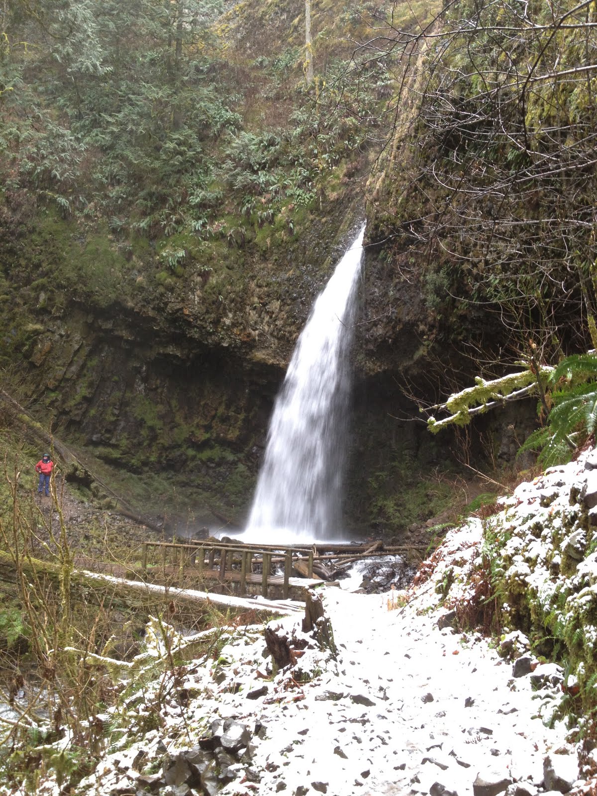
Latourell Falls
Spot the Photographer?
Wahkeena Falls
More Wahkeena
Multnomah Falls (with Google Auto-Awesome)
Each Branch can hold an awesome amount of Ice!
Please don't hike here (stay on paved path)


Share

Monday, December 02, 2013

Hike #7 (11/30/13) - Silver Falls State Park

Since we were in the area of Silver Falls for Thanksgiving dinner #3, we took advantage of the "great weather" and hiked the upper loop that goes under Silver Falls and Lower North Falls.  It was great to get out and burn some calories before eating so much Turkey and Honey Baked Ham!
Share

Hike #6 (11/29/13) Council Crest from Twilliger

Since it was "Black Friday" I got dressed all in black and hit the trails.  The Marquam trail up to Council Crest is one of my classic training hikes but I mixed things up a bit this time by starting on Terwilliger Blvd. and trying out the new "Flicker" section of trail.  http://www.portlandoregon.gov/parks/54709

Share

Monday, November 25, 2013

Hike #5 (11/24/2013) - Hamilton Mountain

After securing our $35 "Washington Discovery Pass" we headed out toward Hamilton Mountain.  What I like to do when I visit this place is to always take the wrong road and end up at the equestrian trail head.  Then after looking at the map I head back down to highway 14, go a few more feet down the road and see the campground road directly across from Beacon Rock.  For $35 a sign and functional toilets might be nice but I digress.  

The trail immediately says "Good Morning" to your calf muscles as you quickly ascend a Doug fir forest to some nice views under the power lines.  The trail levels out a bit and then descends as you visit a few waterfalls.  My favorite is the "Pool of Winds."  Careful in winter as both the railings and the rocks are covered in rime ice.  
Speaking of ice, the trail then starts its steep uphill ascent.  I love the sign that says would you like to try "difficult" or "more difficult."   
Then we started seeing ice along the trail.  
and then finally ON the trail.
Soon we were on the summit the views of which we enjoyed for approx 30 seconds as it was FREEZING cold and the wind was blowing steadily at 20 to 30 MPH.  Wind Chill must have been in the teens...it was brutal.
Took the loop down the backside (i.e. the "difficult") route and avoided the ice / saved my knees for another day.  Hamilton is a great late fall / winter hike!


Share

Saturday, November 16, 2013

Hike #4 (11/15/13)-Larch-Xmas Ornament-Bikel-Franklin-Oneonta

I took a mental health day and made my way to Multnomah Falls (after sleeping in until nearly noon) with the intention of popping over Franklin Ridge and down the Oneonta drainage.  
On the way up to Franklin I was intrigued by the High Water trail and decided to head up.  I was further intrigued by another unmarked side trail.  Well this wasn't my goal for the day but with a turn around time in mind and the fact that these trails and road were generally heading in the right direction I continued on.  I am glad I did as soon I was grinning ear to ear as I walked through a magical trail with hundreds of x-mas ornaments hanging from the trees!
Continuing on across the Multnomah Basin I soon encountered the beautiful Nesika Lodge.  (Owned by the Trails Club whose members I hope to ask questions of at the Meet and Deet)

Next I took in the views from Bikel's Point which looks down on Waespe Point and to the east.  
Ok, time to turn around?  What's this sign beckoning me to continue to Franklin Ridge?  If I headed up I would most definitely be using 1 of the 2 headlamps I was carrying....let's do it!  Climbed up to the intersection with Oneonta, put on my heavy coat as it was getting cold near 3000 ft with dwindling daylight and donned my headlamp.  Took one last picture of Oneonta drainage before the sun went down completely.  

Ok, don't panic...you have extra clothes, food, water, extra batteries....just enjoy the experience of being the only person in this place at that time.  That said the deluge of rain and the ups and downs on the 400 return trail to Multnomah Falls did suck but loved writing down 6 hours and at-least 3000 feet of up in my hike log on a work day!  One question.  How far did I go (GPS went haywire?)
Share

Monday, November 11, 2013

Hike #3 (11/9/13) - Nesmith Point

I am in good shape, but not mountain climbing shape.  Nesmith Point is the type of hike I will use to change that by next spring.  The hike starts at the John B Yeon State Park (off exit 35 on I-84) parking lot.  I was the first one to the lot and the sun was just coming up, so I jammed all that I could from the front of my car to the trunk to help prevent the car window "smash and grab" that sometimes happens in Gorge areas like this.

The first mile is not that bad but then the switch backs started.  My first thought in heading up was, "don't think about how hard this is going to be."  Soon the wonder of it all took over my experience. The high cliffs, the salamanders slowly ascending, the fog rising up through the trees, and blood pulsing through my veins left me feeling great!  Some of these sections are very steep and there are a few rock slide areas to contend with which only adds to the experience of climbing.
About half way up I was quickly passed by a gentlemen who IS in mountain climbing shape and then at about 3.3 miles of climbing you top the ridge at around 3000 ft up.  The next section is an "easy" 1.3 miles along the ridge, though you are still moving UP and I encountered some left over snow from last weekend around 3200 ft.  
  Finally after the slog through the woods you reach the sign post directing you to the top of Nesmith Point.
Next time I would love to explore the other trails in the area but this day I would only make my way to the point itself.  A tree ate the sign at the summit 
but the views were amazing!
Its a great feeling knowing that you climbed all the way up from the river and earned these views at 4300 ft.  On the way back down I took it slow as the steep sections took their toll on my knees returning to the car a little over six hours from when I started.  What a climb!


Share

Saturday, November 02, 2013

Hike #2 (11/2/2013) - Completed the Wildwood in a day challenge!

Got up before sunrise and was on the trail by 7 am.  Got to see the sunrise and sunset today.  33.8 miles (including extra to rendezvous with where my wife parked the car.)  11 hours and 9 minutes (approx. 3 MPH)  Weather outside was freight-full but the trail conditions were delightful.  TIME TO REST.

Share
Friday, October 25, 2013

Hike #1 - Ape Canyon (Last Hiked: 10/26/2013)


Ape Canyon plus hike onto Plains of Abraham
Walk up old growth ridge to plains of Abraham.  Continue on to the Plains of Abraham for as far as you like.
The Details
Miles:  16
Elevation Gain: 3930
To Trail-head: Drive to Cougar WA, then Rd 83 to the trail-head
Season: Summer through October
Link to route map and GPS
Link(s) to other trail descriptions:


My Experience
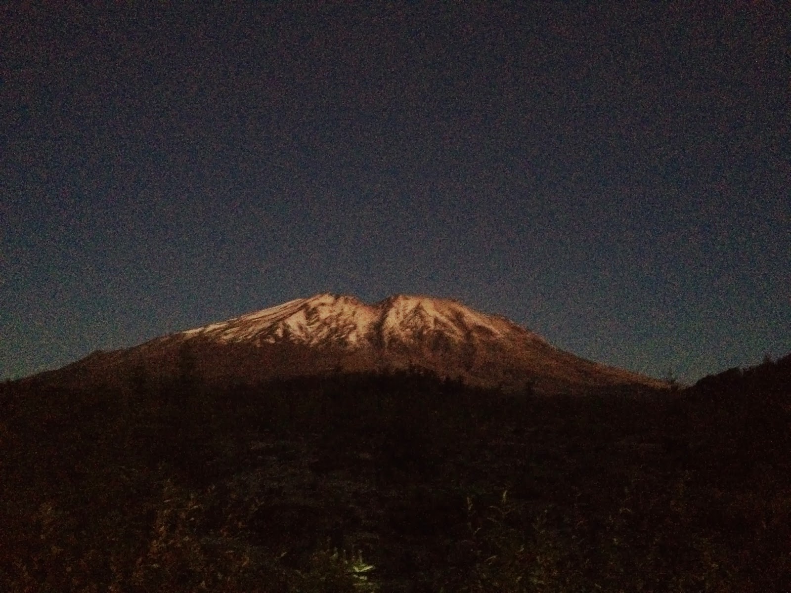
Woke up at 5 am and drove up to Ape Canyon trail head before sunrise.  To my surprise there was a car in the parking lot and a pair of headlamps making their way up the ridge.  About a mile into my hike the sun came up creating a stunning alpenglow over St. Helens.  The fall color was amazing but the peak colors were probably 1 week ago.  I cursed all the downhills but was thrilled to be adding to my total elevation gain as I headed back up the ridge once more.  At about 6 miles you reach the Ape Canyon viewpoint itself and just a little further on you arrive at the junction with Loowit trail which travels all the way around the mountain.  Feeling good I decided to continue up onto the Plains of Abraham to the junction with Abraham trail.  Was so fascinated by the Pyroclastic "bombs" that dot the surface of the plain that I almost did not notice the mountain goat making a parallel hike to mine.  Enjoying the solace the mountain solitude was providing me; I felt I could have continued hiking all the way around the mountain if I had the time.  But ultimately my watch beeped and let me know that I had been hiking for nearly 3 hours and 8 miles and it was time to turn around.  I did a slow but heart rate elevating trail run back to the car (16 miles, 5 hours in total) greeting all the mountain bikers making their way up.  Feels good to have an epic hike completed by the noon hour.


Share

Wednesday, October 23, 2013

The End / The Beginning

If all goes to plan this weekend I will be taking my 52nd hike since I conceived the "52 Hikes" concept.  In 2010 the day after my 34th birthday I was reflecting on how great it felt to complete the long and strenuous hike to the top of Larch Mountain.  If I kept up that pace for 52 hikes in a row I would surely lose the extra 52 lbs i had gained since college while also documenting my journey.

As in life, the 52 hikes journey has been full of ups and downs.   In 2010 the 3 hikes after Larch Mountain ended with a broken into car, a hurt leg and the first and worst blisters of my life.  In 2011 I ended up hiking 24 times including the most memorable hike of my life Munra Point.  In 2012 I had full intentions to continue the journey but my leg gave out (hernia) and I made it an excuse to give up after just 2 hikes.  This year, shortly after my 37th birthday and an 18 month hiatus from hiking I decided it was time to stop making excuses.  I had gained nearly 30 lbs, missed hiking tremendously and was just tired of being tired.

I walked to the end of our street, probably no more than a quarter mile and had to call Isobel to come pick me up.  From there I tried a few small hikes (around 2 miles) walking VERY slowly.  Things started to change on Herman Creek when I discovered that if I could make it past a few miles the endorphins kicked in and the pain in my leg was manageable....too much advil helped too.   By mid-summer I found myself hiking 15 to 18 miles on the Wildwood trail and over the past two weekends I earned nearly 8000 ft of up and 24 miles in the Columbia River Gorge.  So 52 Hikes, is coming to an end.

But this is just the beginning.  I will post my next 52 hikes

Share

Monday, January 16, 2012

1/15/2012 - Latourell Falls

1/15/2012 Latourell Falls. 2.4 Miles, 520 Feet Elevation Gain
Portland Hikers description of Latourell Falls describes the season for this hike as "Year round except during winter storms"  Since it was only snowing and not icy we went for it.  I had promised the girls I would get them to the snow and I also promised them a waterfall and Latourell Falls delivered!  As we arrived at the falls, big snow flakes started to come down. 
Unfortunately unlike last week, my leg gave me a lot of trouble.  I have a muscle hernia through the fascia of my calf muscle that requires surgery to repair.  In the meantime, it's safe to hike but it hurts like hell especially on steep uphill sections.  I found that I could take about 100 steps until the pain was too great.  After 15 to 30 seconds of rest, I could keep going.  Flat and downhill did not hurt as bad and I actually did some trail running to catch up to my family after taking too long to photograph the upper falls.

Monday, January 09, 2012

1/8/2012 - Cape Horn

52 Hikes, 52 Weeks, 52 Lbs.  In 2011 we went on a total of 25 hikes for 110 miles and approx 20,000 feet of elevation gain.  I was very fortunate to have my daughters join me on nearly every hike.  I am proud that we averaged a trip every other weekend but will double that effort this year by hitting the trail 52 times in 2012.  The highlight of 2011 was climbing Munra Point (Search for it on YouTube!) with Ava.  I wanted to quit numerous times and she kept pushing me on and on and we shared a beautiful moment of accomplishment when we reached the top.  I also really enjoyed the Trail of 10 Waterfalls with Helayna as she took my DSLR away from me to capture the fall colors.  

1/8/2012 Cape Horn.  4 Miles, 670 Ft Elevation Gain
My mom moved to Vancouver, WA on New Years day.  Having her 30 minutes away will mean she will get to go on many more hikes with us.  She joined Helayna, Ava and I on Cape Horn this weekend as it's the closest Gorge hike from her house on the WA side.  Taking advantage of the nice new tunnel under Hwy 14, we climbed up to the new overlook.
  
After 30 minutes of extracting all interesting rocks from the gravel, we went back down the trail to enjoy the view from the cliffs overlooking the Columbia River.
I will check tonight at the gym if I lost my first of 52 lbs this year.

Monday, October 31, 2011

Hike #28, Trail of 10 Falls (Silver Creek)

My favorite time to visit the "Trail of 10 Waterfalls" is in the fall when the leaves are changing colors and the crowds have gone home.  The clouds broke as we drove from Portland to Silver Falls State Park http://www.oregonstateparks.org/park_211.php making for fantastic hiking weather (cool and dry!)  The sun in this rare October blue sky day only intensified the color of the leaves & mosses.  This 7.1 mile hike always seems to go too quickly.  You don't even notice the 1300 ft elevation gain as you gradually make your way up the canyon filled with waterfalls around every corner.


Someone else had my camera this time!

I captured all 10 waterfalls using my iPhone in this album for you to enjoy:
2011 - Silver Falls, Trail of 10 Falls


Tuesday, October 04, 2011

Half Way Point

Share
Its been about 16 months since I was resting after a long 14 mile hike to the top of Larch Mountain and thought to myself, I feel great!  It was at that moment that I conceived of 52 Hikes.  If I could commit myself to going on 52 hikes, I could easily lose 52 lbs and feel great 52 times over the course of the next year of my life.  Today, as I updated the map of the places I have hiked on this quest, I noticed that I am half way there.  While it will ultimately take much longer than a year to accomplish this goal, I am proud of the fact that I have made it outdoors 21 times this year (2011) and on the majority of the hikes I have been accompanied by my beautiful daughters and wonderful friends. 

Sunday, March 27, 2011

Coyote Wall and the Labyrinth - in Search of Minotaurs (03/27/2011)

Share
Seeking out the elusive "rain shadow" we set off to Coyote Rock to find the "Labyrinth" and "maybe even some Minotaurs" (according to Ava.)  Was wonderful to feel the legs again as we gained 1126 ft.  We definitely want to go back sometime soon to explore the rest of the Labyrinth!


This map was created using GPS Visualizer's do-it-yourself geographic utilities.

Please wait while the map data loads...